
AI Occupational Exposure score unavailable For more insight, research the specific tasks and skills required for the role.
Explore all careersA Hydrographic Surveyor measures and maps water bodies to support safe navigation, marine development, and environmental monitoring.
Get qualified to work as a Hydrographic Surveyor with a course recognised across Australia. Speak to a training provider to learn more.

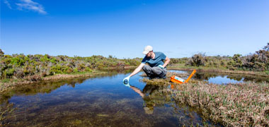
A Hydrographic Surveyor measures and maps bodies of water, ensuring safe navigation and effective marine development. You might work in coastal areas, rivers, or harbours, providing critical data for maritime projects, environmental monitoring, and underwater construction. Hydrographic Surveyors focus on collecting and analysing water depth, seabed topography, and tides using specialised equipment. You’ll prepare detailed charts and reports that support marine operations and coastal management.
Hydrographic Surveyors play an essential role in the maritime industry. You’ll need to be detail-oriented and skilled in using sonar, GPS, and data analysis software. You’ll collaborate with engineers, environmental scientists, and government agencies to ensure the safe and sustainable use of marine resources.